One Watershed One Plan
Redeye River
The Redeye River Watershed contains three major river systems: The Redeye, Leaf, and Wing Rivers. The Redeye River flows southeast from Wolf Lake (in Becker County) to the confluence with the Leaf River halfway between Aldrich and Nimrod. The Leaf Rive flows east from the Leaf Chain of Lakes (in Otter Tail County) to the confluence with the Crow Wing River north of Staples. The Wing River flows northeast, starting near Parkers Prairie and flowing into the Leaf River north of Verndale.
The landscape is varied, with forests dominating the northern half of the watershed and agriculture the dominant land use in the southern half. Wetlands dot the landscape, including the Leaf River Valley. Lakes are absent from much of the watershed, only forming around the edges of the watershed.
Our completed Leaf, Wing, Redeye One Watershed, One Plan document will help us balance all of these competing land features and differing land uses for a healthy watershed. In our plan we focus on land management as the key tool that will help to protect our rivers and lakes. If you wish to see more or download a copy of the plan, please click on the 'details' link below.
Otter Tail River
The Otter Tail Watershed 1W1P area covers 5 counties: Otter Tail, Becker, and small portions of Clearwater, Mahnomen, and Clay. The water flows south through Becker and Otter Tail to Orwell Dam in southwest Otter Tail. From there it flows west toward the Red River of the North. However, the planning process for this watershed only include the area upstream of Orwell Dam. Why?
- The land use in the Lower Otter Tail River is vastly different from the rest of the watershed
- The land geography and geology are very different from the rest of the watershed
- The area downstream of Orwell Dam is covered by the Buffalo-Red Watershed District
- The issues are similar to those in the remainder of the Red River Basin than the rest of the Otter Tail River
- The Buffalo-Red Watershed District included the Lower Otter Tail River in their completed 1W1P
Even without the section south of Orwell Dam, the Otter Tail River Watershed varies greatly. In the north, forests and wetlands dominate the landscape. In the middle of the watershed numerous lakes cover the land, in the east irrigated cropland is common, and in the southwest non-irrigated cropland is more common. Of course, this is a bit of a simplification and these practices and land types overlap and interact throughout the watershed. Balancing all of these various land uses and regions is an important part of the 1W1P process. Read on fro more details.
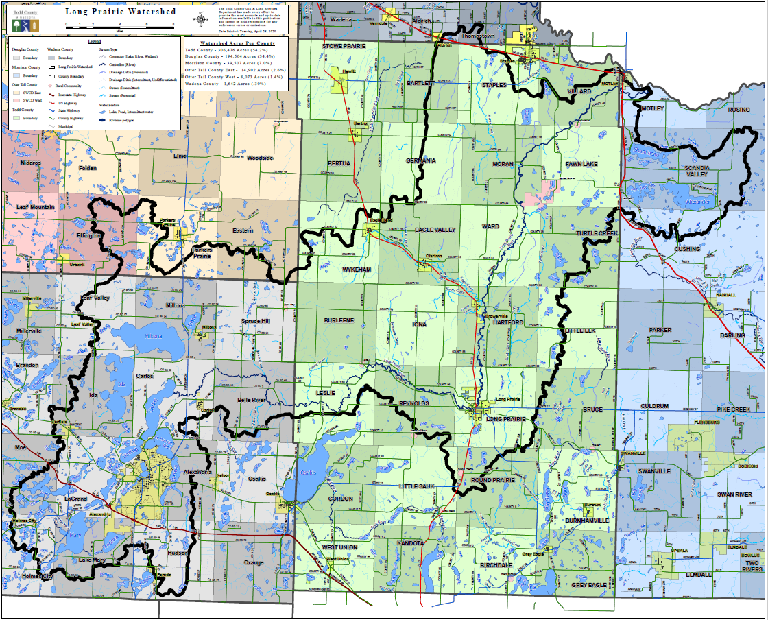
Long Prairie One Watershed, One Plan
One Watershed, One Plan is now in full swing in the Long Prairie Watershed.
Information can be found on the Todd County Watershed page, link below.


